Published: October 18, 2026 | Author: Karl Huang
Most travelers rush through Guozigou without realizing they have just crossed one of the most decisive lines in Xinjiang. We drove it on a Tuesday in late May, leaving the cold, thin air of the Dzungarian side behind and, within half an hour, pulling into green pasture where a herder was already moving sheep toward a creek. The valley is only 28 kilometers long, but it separates two different Xinjiangs. This guide comes from that drive, plus the historical records and engineering facts that explain why the pass mattered long before the bridge did.
| Item | Detail |
|---|---|
| Location | Huocheng County, Ili Kazakh Autonomous Prefecture, northern slope of the Tianshan |
| Length of valley | About 28 km, running west from the Sayram Lake basin to the Ili Valley floor |
| Historic role | Northern Silk Road throat, known as the “Iron Pass” (铁关) |
| The bridge | G30 Lianhuo Expressway cable-stayed bridge, opened 30 September 2011 |
| Bridge specs | 700 m long, 360 m main span, deck roughly 200 m above the valley floor |
| Best window | May to early June for wild fruit blossom; June to September for green pasture |
| How to cross | By car or bus on the G30; no separate ticket for the pass itself |
Two worlds in one valley
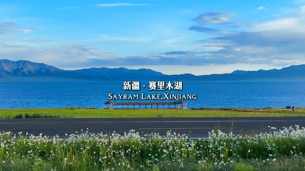
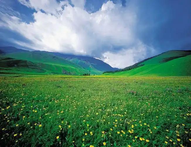
The first thing that surprised us was the weather. East of the pass, around Sayram Lake, the wind comes straight off the steppe and the ground stays bare well into spring. The moment the road drops into Guozigou, the air turns damp and the slopes fill with trees. Local drivers call this the edge of the Ili Valley’s microclimate, and the change is not subtle. One side is the dry north; the other is the wettest part of Xinjiang, where annual rainfall supports forests and hay meadows that you will not see anywhere else in the region.
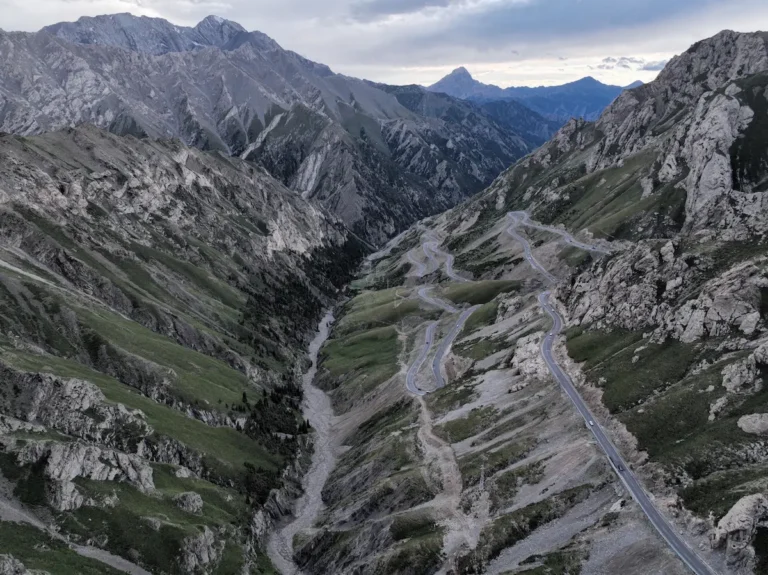
That contrast is the whole reason the valley matters. For centuries it was the only practical break in the mountain wall between the Dzungarian basin and the fertile Ili River country. Armies, merchants, and pilgrims all funneled through the same narrow gorge, and the people maintaining the road today still talk about how the old mountain route could close for days after a single snowstorm.
The Silk Road “Iron Pass” and the wild fruit forests
Long before the highway, Guozigou was the “Iron Pass” of the northern Silk Road. The name 果子沟 means “fruit valley,” and it is not marketing. The surrounding hills carry some of the last wild apple and apricot forests in the Tianshan, remnants of the ancestral fruit trees that botanists link to every cultivated apple in the world. In the 13th century the Taoist traveler Qiu Chuji crossed here on his way to meet Genghis Khan and wrote that no other landscape had struck him as so strange and beautiful. Two centuries later the Qing official Hong Liangji described “a hundred waterfalls and a thousand cliffs,” and in the early 1900s the explorer Xie Bin compared the gorges favorably with Guilin. The Yili news outlet’s account of the gorge’s history collects these quotes in one place.
Walking a short stretch of the old roadbed above the modern bridge, we could see why it earned those lines. The cliffs are close, the river is loud, and the fruit trees still come into blossom every spring. It is a working pass, not a ruins site, so there is nothing to “enter” for a fee, but the roadside pull-offs on the older alignment give you the view the ancient travelers had.
The bridge that ended a 24-hour journey
The modern Guozigou Bridge is the reason most visitors today barely notice the pass at all. Opened on 30 September 2011 as part of the G30 Lianhuo Expressway and the Sayram-to-Guozigou highway section, it is a twin-tower, double-cable-plane steel-truss cable-stayed bridge: 700 meters long, with a 360-meter main span and its deck about 200 meters above the valley floor. It was Xinjiang’s first cable-stayed highway bridge and, at the time, the tallest highway bridge in the region. The China Daily profile of the G30 and the bridge gives the construction detail.
The change for ordinary travelers was dramatic. Residents we spoke with remembered the 1990s, when reaching Urumqi from the Ili Valley meant a 24-hour-plus bus ride on a winding mountain road, and snow could trap vehicles in the gorge for days. After the bridge, the same trip became a same-day drive. That is the real story of Guozigou: not the structure itself, but the way it collapsed a week of isolation into a few hours. The People’s Daily report on the pass describes it plainly as the natural gateway to the Ili Valley.
Getting there: driving the G30 through Guozigou
Guozigou sits on the G30 Lianhuo Expressway between Sayram Lake and Yining. If you are self-driving from Urumqi, the pass is roughly the midpoint of a long but straightforward highway day; from Sayram Lake it is a short, scenic descent of under an hour. Long-distance buses between Urumqi and Yining also cross it, and the bridge is visible from the road for several kilometers as you approach from the east.
There is no separate entrance fee or ticket gate for the valley. You simply drive through. The one thing to watch is weather: even in summer the high pass can see sudden rain or hail, and in late autumn the early snow can slow traffic. Check the forecast the morning you leave, and give yourself daylight for the crossing so you can use the pull-offs.
When to cross: seasons, blossom, and light
Timing changes what you see. Late April to early June is the wild fruit blossom season, when the apricot and apple trees along the slopes turn the gorge white and pink; this is also when the best time to visit Xinjiang guides point travelers toward the Ili Valley for exactly this reason. From June through September the pastures stay green and the light is soft in the early morning. Winter is quieter and often closed by snow on the high sections, so most visitors plan the crossing for the warmer half of the year.
For photography, the eastbound descent in the afternoon gives you the valley opening toward Sayram, while the westbound approach catches the bridge lit against the cliffs. Either way, pull over only where it is safe; the expressway shoulders are narrow.
Basing yourself on the Ili side
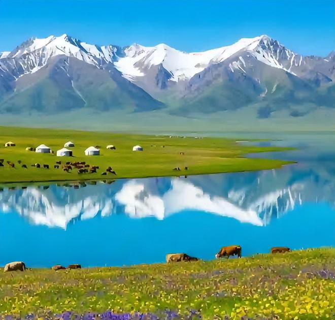
Most people do not sleep in the pass itself. The logical base is Yining, the Ili Valley’s main city, about an hour west, which has the full range of hotels from budget to comfortable international-standard rooms. Closer to the pass, Huocheng (the county that contains Guozigou) offers smaller guesthouses and is itself worth a night in July when the lavender fields are in bloom. If you want to break the Urumqi-Yining drive, Sayram Lake has seasonal yurts and a few hotels at the east end of the pass.
Eating your way into Yili
The food shifts the moment you cross. On the Dzungarian side you are still in wheat-and-noodle country; west of Guozigou the table turns to the dairy- and meat-rich diet of the pastoral Ili Valley. Look for naan fresh from the tonur, thick yogurt with honey, hand-pulled laghman, and the local lamb cooked over coals. In Yining and the smaller towns near the pass, the Kazanqi quarter and the evening night markets are the easiest places to sample several dishes in one walk.
Practical tips before you go
- Carry cash and a full fuel tank; the pass has no major services between Sayram and the Ili floor.
- Download offline maps. Mobile coverage is patchy in the gorge even though the bridge itself has signal.
- If you are prone to altitude effects, note the pass sits above 2,000 meters; the change is mild but real after a long drive.
- Respect the herders. The slopes are working summer pasture, and gates or flocks may slow you for a few minutes.
- Pair the drive with a stop at Sayram Lake at the eastern mouth, which is the natural start of the crossing.
A 2-day Yili gateway route
This is the loop we would run if it were our first time:
Day 1 – Sayram to Yining. Start at Sayram Lake in the morning, cross Guozigou midday, and spend the afternoon in Huocheng or continue to Yining. Sleep in Yining.
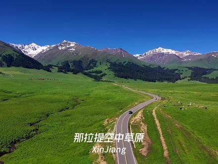
Day 2 – Yining and the valley. Walk the Kazanqi old town, visit a lavender farm if it is July, and decide whether to push on to Narat or return toward Urumqi the same evening. The pass is just as pretty on the way back, and the light is different.
For readers who want the engineering side of the same story, our companion piece on the Guozi Valley Bridge’s design and crossing experience covers the structure in detail.
Frequently asked questions
Is there an entrance fee for Guozigou? No. The valley is crossed on the public G30 expressway, and there is no ticket gate. You pay only standard highway tolls if you are driving.
Can I visit the bridge on foot? Not as a structure to walk across; it is an expressway bridge. The views are from the road and from the older roadside pull-offs. The best photographs come from a safe stopping point on the descent.
How long does the crossing take? The valley itself is about 28 km, so driving through takes roughly 30 to 45 minutes without stops. Most people budget two to three hours to include Sayram Lake and photo stops.
When is the fruit blossom? Usually late April to early June, depending on the year’s snowmelt. Apricot and wild apple bloom first, then the deeper woodland flowers.
Disclaimer
This article is based on the author’s May 2026 drive and on publicly reported facts from Chinese transport and local-government sources. Opening dates, road conditions, and seasonal blossom times change with weather and maintenance. Confirm the latest G30 conditions with your rental company or a local host before you travel, and check border and permit rules if you plan to continue west toward Khorgos.
About the author
Karl Huang is a travel writer focused on Xinjiang’s overland routes, from the Dzungarian steppe to the Ili Valley. He has driven the major Tianshan passes and writes practical, first-hand guides for independent travelers.