Published: 31 August 2026 | Author: Karl Huang
Most visitors to southern Xinjiang hear about the Karakoram Highway to Pakistan or the Pamir road to Tashkurgan. Far fewer know that the same region holds the southern Xinjiang stretch of the G219 — the old Xinjiang–Tibet highway — which begins at a stone marker in Yecheng (Kargilik), at the foot of the Kunlun range, and climbs for hundreds of kilometres before it ever reaches Tibet. I have driven the Yecheng-to-Kudi approach more than once while reporting on the corridor, and I have sat in the teahouses of Kargilik listening to truckers who run the whole line to Ali. This guide is built from those trips and from the practical questions every driver asks: where does the road actually go, what permits sit in the way, and is it worth the altitude?
| Detail | At a glance |
|---|---|
| Route | Yecheng (Kargilik) → Kudi → Mazar → Heika → Xaidulla → Dahongliutan → Xinjiang–Tibet border |
| Xinjiang length | About 660 km from Yecheng to the border pass |
| Highest point | Border pass (Jieshan Daban) above 5,200 m |
| Average elevation | Over 4,500 m for most of the climb |
| Best window | Late May to early October; snow closures Nov–April |
| Fuel | Fill in Yecheng; next supply at Xaidulla, rationed |
| Permits | Required — border/military area, often via registered group |
What the G219 southern section actually is
The G219 is the longest national highway in China, running from the Altai in the north to Dongxing on the Vietnamese border in the south. But the part that matters here is the original Xinjiang–Tibet Highway, completed in 1957. Its traditional zero marker stands in Yecheng (Kargilik), a county town under Kashgar Prefecture at about 1,365 metres. From that stone, the road turns south and begins a long, relentless ascent of the northern face of the Kunlun.
Unlike the Karakoram Highway, which heads southwest toward Pakistan, the G219 turns the other way: it follows the Kunlun foothills, crosses into Hotan Prefecture, and only leaves Xinjiang at the Xinjiang–Tibet border pass. So when people say “Kashgar to Hotan along the Kunlun,” they are describing the Xinjiang portion of this road — the part that stays inside the region before the truly extreme altitudes begin.
Why this stretch carries the Kunlun in its name
The Kunlun is not a single ridge you cross and forget. Between Yecheng and the border it is a wall of ranges, some peaks permanently snowed, others bare rust-coloured rock. The road is carved into the southern edge of the Taklamakan’s rim and then climbs onto the mountain itself. When we drove the lower switchbacks above Kudi, the green of the Yarkand River valley dropped away within an hour and gave way to grey scree and thin air. That transition — oasis town to high mountain desert in a single morning — is the defining character of the drive.
Starting at the Yecheng zero marker
Yecheng is the last real town. It has fuel, hotels, repair shops and the police checkpoint where the paperwork starts. We filled every container we could before leaving, because the next dependable fuel is hundreds of kilometres up and rationed. The marker itself is a humble concrete post, easy to miss, but it is the symbolic start of one of the highest paved roads on earth.
Spend a night here if you can. At 1,365 metres it is low enough to sleep, and it lets your body meet the road gradually rather than after a single brutal climb.
The climb: Kudi, Mazar and Heika passes
Three named passes dominate the first day. Kudi Pass (Kudi Daban) sits near 3,200 metres and is the first real wall — a series of tight hairpins where the road gains 2,000 metres of height from the town below. Above it, Mazar Pass (Mazar Daban) reaches close to 5,000 metres, and most people feel it: a dull headache, shortness of breath, a strange tiredness that no amount of sleep fixes. The third, Heika Pass (Heika Daban), around 4,900 metres, brings you onto the high plateau proper. On our run the temperature at Mazar was minus four in early June, with wind that cut through every layer we owned.
The Hotan Prefecture outposts — Xaidulla and Dahongliutan
This is the part that surprises people: the road does not leave Xinjiang at the top of a pass. It runs for a long way inside Hotan Prefecture, through mountain settlements most maps barely show. Xaidulla, also called San Shili Ying Fang (“Thirty-Mile Battalion”), is the main supply town at around 3,600 metres — a clutch of guesthouses, a clinic and the one real place to eat and sleep between Yecheng and Tibet. Farther south, Dahongliutan (“Big Red Willow Shoal”) sits above 4,200 metres in Hotan County. Between them lie the Kangxiwar Martyrs’ Cemetery and the ruined Saitula sentry post, both worth a quiet stop if the road is open.
The Karakash, or Black Jade River, runs through this section, which is why Hotan’s jade trade and this mountain road share a name in local memory — the river that feeds the jade markets rises here in the Kunlun.
Getting there: transport and the drive itself
Most travellers reach Yecheng from Kashgar, a paved four-to-five hour run on the G3012. From Kashgar you can also branch onto the Karakoram Highway toward Pakistan or head up to Tashkurgan and the Pamir — both easier, prettier in a conventional sense, and open to far more visitors. The G219 south is the harder cousin. Self-drive is possible only with the right permits and a capable vehicle; many people instead join a registered overland group that handles the border paperwork.
When to go (and when the road shuts)
The reliable window is late May to early October. Snow can close Kudi and the higher passes from November through April, and even in May a cold snap will shut Mazar for days. We found late September the calmest: cold nights but clear passes and almost no landslide risk. July and August bring warmer roads but afternoon thunderstorms that trigger rockfall on the lower gorges. There is no perfect month, only a trade-off between cold and closure risk.
Fuel, food and altitude: the logistics that matter
Carry more fuel than you think you need, plus spare tyres and water. Mobile coverage disappears for long stretches; download offline maps before Yecheng. Food is basic — noodles, flatbread, the occasional hotpot at Xaidulla. Altitude is the real enemy: ascend slowly, drink constantly, and turn back if symptoms worsen. The clinic at Xaidulla handles mild cases, but serious altitude illness means descending, not waiting.
Staying safe at 4,500 metres
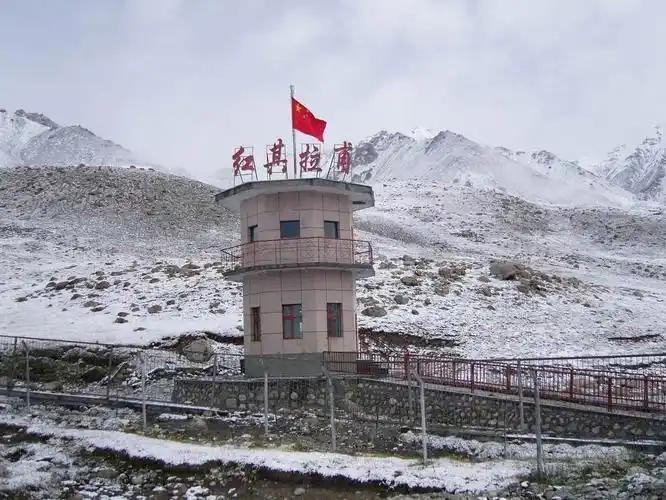
The road averages above 4,500 metres for much of its Xinjiang length, and the border pass tops 5,200. That is thin enough air that fit young drivers faint at the wheel. Do not plan the climb as a long single day. Break it at Xaidulla, sleep low when you can, and keep a pulse oximeter in the glovebox. If you have heart or lung issues, this road is not for you, plainly.
A realistic sample run: Yecheng to the Tibet border
Day one: Kashgar to Yecheng (fuel, checkpoint, sleep). Day two: Yecheng to Kudi Pass, overnight at a lower spot if you feel the altitude. Day three: Mazar and Heika passes to Xaidulla (3,600 m, the comfortable high base). Day four: Dahongliutan and on toward the border pass, then into Tibet if your permit allows. Few private cars do the whole thing without a support vehicle, and honestly most visitors are happier turning back at Xaidulla and spending the saved energy in Hotan or Kashgar.
If the full G219 is too much — gentler Kunlun alternatives
You do not have to commit to the Tibet crossing to feel the Kunlun. The Pamir road to Tashkurgan gives you high mountain passes on a paved international route with far fewer permits. The southern Tarim loop on the G315 runs along the same mountain front at low altitude, past oasis towns and jade markets. Both are easier, safer, and still unmistakably Xinjiang.
Frequently asked questions
Can foreign tourists drive the G219 south? Not freely. It is a border-area military road; permits and often a registered group are required, and rules change. Check current regulations before you plan.
How high does it get? The Xinjiang section averages above 4,500 m, with the border pass over 5,200 m.
Is it paved? Yes — the whole line was asphalted by 2013 — but weather still closes sections.
Where is the last fuel? Yecheng, then rationed supply at Xaidulla. Carry reserves.
Do I need to acclimatise? Strongly yes. Sleep in Kashgar and Yecheng first; climb gradually.
Disclaimer
This article is a travel account and planning aid, not official advice. Border permits, road closures and fuel availability on the G219 change without notice, and altitude sickness is a genuine medical risk. Always confirm current conditions with local authorities and a licensed operator before attempting the route. The author and publisher are not liable for any outcome of following this guide.
About the author: Karl Huang is a travel writer focused on Xinjiang’s overland routes. He has covered the Kashgar–Yecheng corridor and the Pamir and Karakoram highways, and works from first-hand reporting rather than second-hand summaries. His articles aim to give independent travellers the practical detail that brochures leave out.