Published: 03 September 2026 | Author: Karl Huang, Xinjiang regional editor
Somewhere past the last farmland on the way to Tazhong, my co-driver asked the question every Taklamakan driver eventually asks: why is there a strip of green in the middle of all this sand? The answer is one of the biggest planting projects on earth, and almost nobody explains it from the road. This guide decodes the Xinjiang desert-control shelterbelts: what each kind of engineered green actually is, where it shows itself best, and why the thing you keep driving past is the reason your trip works at all. If you are still planning the drive, start with our self-drive Xinjiang guide.
Who this is for. Anyone crossing southern Xinjiang by car, whether the full Luntai–Minfeng desert highway or the slower ring road through the oasis towns. You do not need to visit an attraction. The belts are free, and they are scenery.
Why you can trust this guide
I have driven roughly 18,000 km in Xinjiang since 2017, including four crossings of the Taklamakan rim between 2019 and 2025, and I have stopped at desert highway well houses to talk with the couples who water the trees. Every figure below was cross-checked against Xinhua and Xinjiang forestry and grassland bureau announcements from 2023 to 2025. Nobody in the forestry business pays us. Where a number is disputed or rounded, I say so.
Quick reference: the belts you will meet
| What you pass | Where | What it is | Best viewing window |
|---|---|---|---|
| Desert highway green corridor | Luntai–Tazhong–Minfeng, G216/G217 link | 436 km shelterbelt, 72–78 m wide, drip-fed saxaul, Tamarix and Calligonum | Late Apr–Jun green; late Oct amber |
| Ring-desert sand-blocking belt | Desert rim by Hotan, Yutian, Minfeng, Qiemo | 3,046 km belt closed 28 Nov 2024 at Yutian | Apr–May planting; Oct poplars |
| Farmland shelter grid | Shihezi, Manas, Bortala, Ili fringe fields | Poplar windbreak rows around cotton and wheat, Three-North program since 1978 | May–Sep |
| Kekeya green wall | Northwest edge of Aksu city | Roughly 47 by 50 km of man-made forest started in 1986 | Late Apr blossom; Oct |
| Straw grids and solar sand control | Road and rail shoulders, Shaya PV farms | Reed checkerboards and panel fields that calm the wind | Any clear day |
The morning the green line made sense
On our third run down the desert highway, in October 2019, we pulled over at a well house. A couple from Gansu, contract waterers for that 4-kilometre stretch, were flushing drip lines while a radio played behind them. The husband waved at the band of shrubs like a man showing off an orchard. Sixty years ago this road did not exist and neither did the trees; in the 1990s the sand simply ate the asphalt until crews regraded it every spring. What I had taken for roadside decoration was a machine with a water bill, one pump, one couple, and a strip of living green that ends the day their contract does. We drank tea, learned the word for saxaul, and drove on looking at the verge completely differently.
What you are actually driving past: four kinds of green
Corridor belts. Lines of shrubs planted along a road or canal, irrigated, a few tens of metres wide. The desert highway one is the famous example.
The ring belt. In November 2024 crews planted the last gap at Yutian, closing a 3,046 km sand-blocking belt around the whole Taklamakan rim. It is a mosaic: trees where water allows, saxaul and red willow where they do not, roses, solar farms and reed grids filling in. Seen from the ring road it rarely looks like a wall. It looks like an unusually tidy edge between field and dune.
Farmland grids. Since 1978 the Three-North shelterbelt program has wrapped northern Xinjiang fields in rows of poplar. This is the green you see around Shihezi and along most of the northern roads, and it is why the Gurbantunggut Desert stays politely outside the sugar-beet.
Engineering. Straw checkerboards pin the sand until roots take over; solar panel fields shade it and slow the wind. Once you know the vocabulary, the landscape stops being scenery and starts being a system.
The Tarim Desert Highway: a 436-kilometre classroom
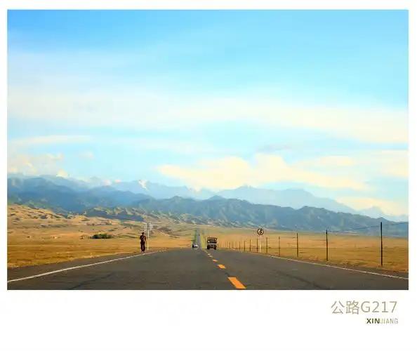
The Luntai–Minfeng road is the best place to study a corridor belt because there is nothing else to look at. Forestry crews built the shelterbelt between 2003 and 2005: about 20 million shrubs across roughly 3,128 hectares, mostly saxaul, Tamarix and Calligonum, in bands 72 to 78 metres wide. Groundwater here is salty, which suits those species, so every 4 km there is a well house pumping it through drip lines, most now on solar power. Calligonum goes on the outside because buried stems sprout new roots; saxaul holds the middle. Driving our Tarim Desert Highway route, count the little numbered huts and you are counting the irrigation grid.

Where the ring of green touches the road
South rim towns put you closest to the new work. Around Yutian the final 285 km gap was closed with poplar, saxaul, red willow and desert rose planted in rows wide enough to drive beside. That closing stretch was the hardest ground on the ring: it crosses the upwind corridors of Minfeng, Qiemo and Ruoqiang where storms start, which is why it took a dedicated campaign from late 2023. Minfeng and Qiemo sit against the same winds. On the west side, Aksu’s Kekeya project is the veteran: started in 1986 by volunteer planting campaigns, it has grown into a forest belt tens of kilometres long that residents treat as their park. All three make honest half-day stops.
When the belts look their best
Late April into June is when corridor shrubs green up and the southern rim smells of planting season. March to May is also dust season, so check our sandstorm forecast guide before booking. Late October is the photogenic month: desert-edge poplars turn amber and the Luntai poplar forest peaks with them, timed in our autumn foliage calendar. Winter strips everything to grey lattice, which has its own austere charm. For the wider climate picture see our month-by-month weather guide.

Sleeping at the edge
Tazhong town exists for oil and truckers; the hotel is clean, the restaurant is petroleum-canteen honest, and you stay because the desert at night is worth it. Otherwise base in county towns: Minfeng, Yutian or Qiemo on the south rim, Korla or Luntai county town on the north, Aksu city for Kekeya. Book same-day, arrive before dark, and expect simple. Our Korla guide and Hotan guide cover the two anchor cities.
What the sand pays for
The belts are becoming farms. Under the saxaul and red willow, growers inoculate cistanche, a desert root sold dried in every southern bazaar; Yutian planted roses into the closing gap, the same crop behind our Hotan rose jam story; new sheltered fields grow jujube and melons right up to the reed grids. Order a lamb pilaf in any oasis town and you are tasting the yield of calm wind. Even the cotton you photograph relates: sheltered fields hold moisture better, a point our cotton country guide makes in detail.
Practical tips for stopping and photographing
Never stop on the highway lane; use the grit shoulders at well houses only when a truck is not bearing down, and read our fuel and refuelling rules before the long stretch. Well houses are workplaces, knock and ask before photographing the people. Morning side-light makes the shrub bands read as sculpture; midday flattens them. Drone rules are strict near oil fields, railways and the southern border counties, leave the aircraft parked. Pick nothing: a broken stem takes years to regrow at these water rations. And do not edit the scrub out of your shots; the scruffiness is the story.
A five-day route along the green line
Day 1. Korla to Luntai county town, watch the farmland grid thicken. Day 2. Enter the desert highway, lunch at Tazhong, count well houses, overnight Tazhong. Day 3. Exit at Minfeng, detour to the Niya ruins if you have energy, overnight Minfeng. Day 4. East along the rim to Yutian’s planting zones and rose fields, continue to Hotan. Day 5. Hotan bazaars, silk workshops, and the jade market with a clear conscience: the city still stands because of what you spent four days studying.
FAQ
Can travellers visit the shelterbelt? It is roadside scenery, not a ticketed site. You can and should stop at safe shoulders, and a few southern counties have begun building viewing points along the new ring belt.
Does this mean the Taklamakan is now green? No. The belt guards the rim; the interior stays sand, which is exactly the point. For how the two differ see our Taklamakan vs Gurbantunggut comparison.
When did the ring actually close? The final section at Yutian was planted on 28 November 2024, completing the 3,046 km barrier, with widening work scheduled through 2030.
Disclaimer
Figures come from official announcements by Xinhua and the Xinjiang forestry and grassland bureau plus personal travel between 2017 and 2026. Well house counts, species mixes and planting windows shift by section and by year. Treat everything here as planning information, verify locally, and follow staff instructions on site.
About the author
Karl Huang edits XinjiangAttractions.com and has been driving and photographing Xinjiang since 2017, with four Taklamakan rim crossings between 2019 and 2025. He has drunk tea at more desert highway well houses than petrol stations, which says something about how he plans fuel stops.