Published: July 26, 2026 | Author: Fiona McArdle, road-trip writer
Most travelers treat the road south of Kashgar as a straight line: drive down, see Karakul, sleep in Tashkurgan, drive back. That works, but it means covering the same 300 kilometers twice. There is a better way. The Pamir Plateau circuit turns the out-and-back into a loop — down the Karakoram Highway to Tashkurgan, then east over the Panlong switchbacks to Yarkand, and back north to Kashgar through the oasis towns. I have driven it twice, once in September 2024 and again in May 2026, both times with a hired driver because foreign licenses are useless here. This guide covers permits, the route stage by stage, where the checkpoints are, and the mistakes I made so you can skip them.
Why you can trust this guide
I write about mountain roads for a living — I have done the Transfagarasan, the Leh-Manali road, and a good chunk of the Pamir Highway on the Tajikistan side. The Chinese side of the Pamirs is a different animal: better asphalt, more paperwork. Everything below comes from my own two trips, cross-checked against what our driver Memet (twelve years running this route) told us and against the permit rules posted at the Kashgar Public Security Bureau as of my last visit. Prices and rules shift, so treat numbers as a snapshot, not gospel.
Quick reference: the Pamir Plateau circuit at a glance
| Item | Details |
|---|---|
| Route | Kashgar → Ghez Canyon → Karakul Lake → Tashkurgan → Panlong Ancient Road → Yarkand → Kashgar |
| Distance | Roughly 980 km for the full loop |
| Days needed | 3 minimum, 4-5 comfortable |
| Highest point | Subash Pass area, about 4,100 m; Panlong road tops out near 4,200 m |
| Permit | Border defense pass required beyond Ghez checkpoint; arranged in Kashgar |
| Driver + car | 1,000-1,400 CNY per day in 2026, fuel included |
| Best months | May-June and September-early October |
| Cell signal | Good in towns, dead zones between Ghez and Karakul |
The paperwork, honestly
You cannot do this loop on a whim. Everything past the Ghez checkpoint sits in a border zone, and foreigners need a border defense pass (边防证). On my first trip a Kashgar agency arranged it in one working day for 100 CNY per person; our hotel just needed passport scans. On the second trip it took two days because a holiday intervened. Book your driver first — most drivers work with an agency that bundles the permit into the price. Do not show up at the Ghez checkpoint without it. We watched a French couple get turned around there in 2024, a 90-minute drive wasted each way.
One more thing: the pass lists the counties you may enter. Make sure Tashkurgan AND Yarkand are both on it if you want the full circuit, otherwise you will be forced to backtrack the way you came.
Stage one: Kashgar to Karakul Lake
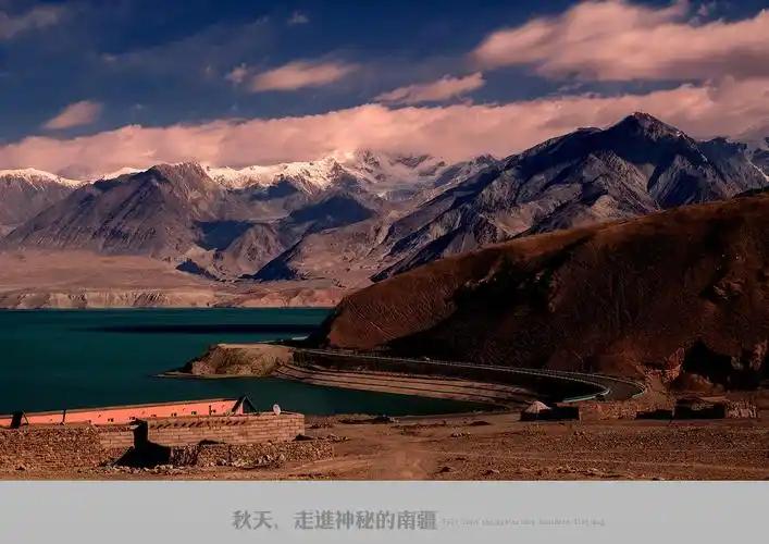
Leaving Kashgar the land is flat, dusty, and busy with donkey carts and melon stalls. That ends abruptly at Ghez Canyon, where the road squeezes between red rock walls and the Ghez River runs grey with glacier flour. The checkpoint sits at the canyon mouth; budget 20-40 minutes depending on the queue. Past it, the road climbs hard. My ears popped three times before the White Sand Mountain viewpoint, where a broad pale dune field drops into a reservoir-fed lake. The water is a strange milky turquoise — nothing was photoshopped, that is genuinely what it looks like on a clear day. If you want more detail on this stop, we wrote a separate Baisha Lake guide.
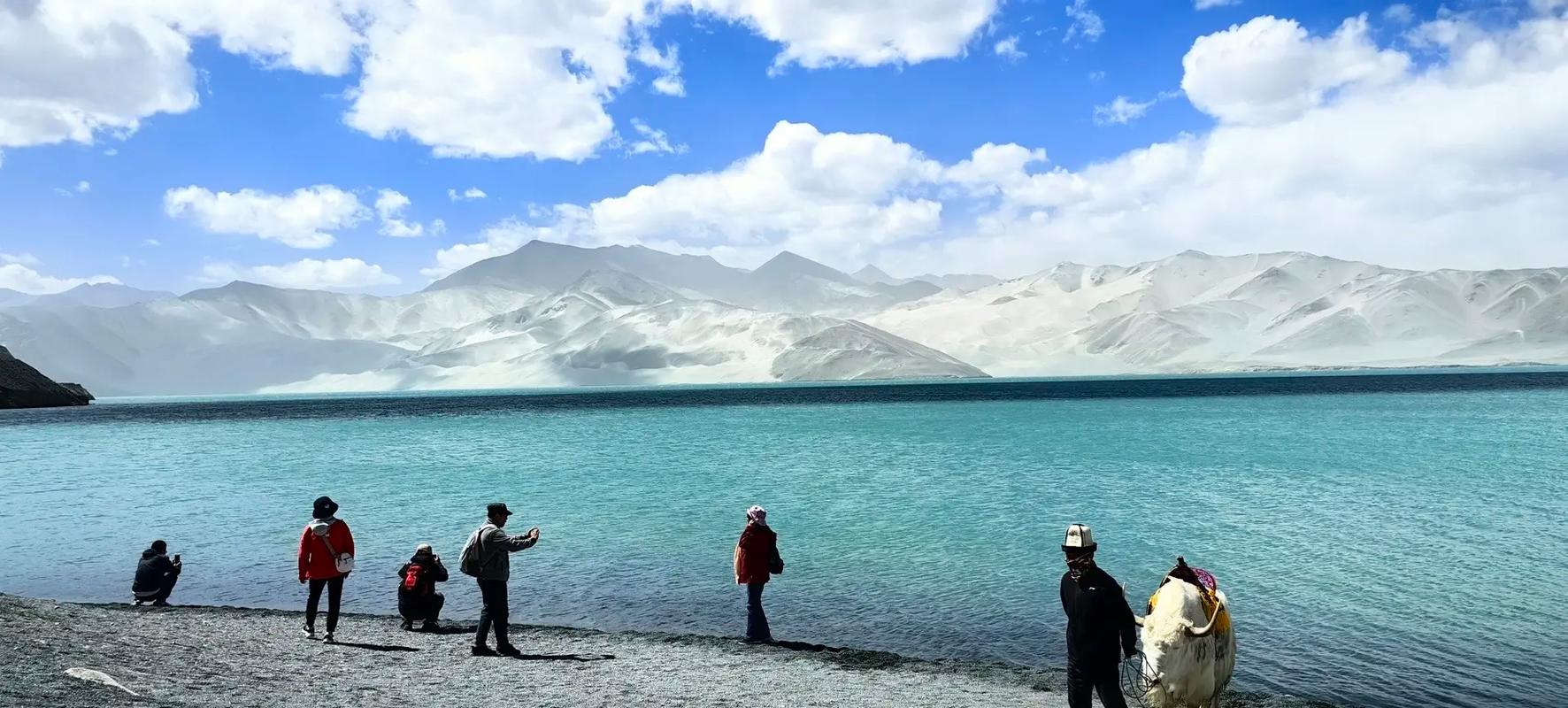
White Sand Lake, the first big stop on the climb from Kashgar. The pale dunes behind the water gave the place its name.
Karakul Lake comes about an hour later, at 3,600 meters, with Muztagh Ata’s ice cap filling the southern sky. In September the lake was mirror-flat at 8 a.m. and choppy by noon, so schedule your photo stop early. Kyrgyz families sell yak yogurt near the parking area; ours came in a plastic bowl with sugar sachets and cost 15 CNY. My driver refused to let me linger more than an hour — his rule of thumb was that everyone feels fine at Karakul and regrets it at bedtime. He was right. Read up on altitude sickness prevention before this trip; the loop spends most of a day above 3,500 meters.
Stage two: Karakul to Tashkurgan
The stretch after Subash Pass flattens into wide yellow-brown valleys where yaks graze against snow peaks. This is my favorite driving hour in all of China. Tashkurgan itself is small — one main street, essentially — but it earns a full afternoon. The Stone Fortress ruins sit on a bluff above the golden grassland boardwalk, and the light between 6 and 8 p.m. (remember, Xinjiang runs on unofficial local time two hours behind Beijing clocks) turns the wetland channels to copper. Our homestay host, a Tajik woman named Gulbahar, put out apricot jam she had made herself and corrected my pronunciation of “rakhmat” — thank you — about six times over dinner. For the town itself, hours, and hotel options, see the full Tashkurgan travel guide, and if you are curious about the people who make this corner unlike anywhere else in China, our piece on Tajik culture in the Pamirs is a good primer.
Ruins on the edge of the plateau. Tashkurgan’s Stone Fortress has guarded this valley for over a thousand years.
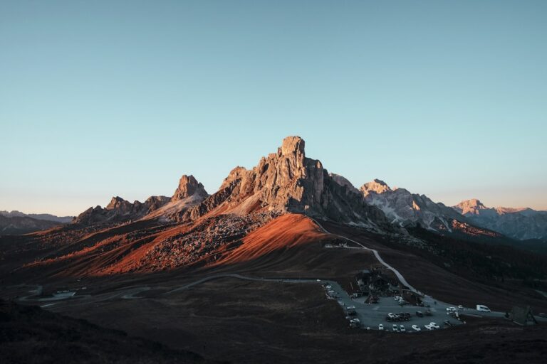
If your permit allows, a side run to the Khunjerab Pass gate at 4,700 meters adds half a day. The border post is closed to foreign crossings without a Pakistan visa and onward plans — that whole journey is covered in our Kashgar to Islamabad KKH guide — but Chinese tourists drive up just to touch the gate, and in 2024 foreigners could too, permit permitting. It was minus 2°C up there in September while Tashkurgan sat at 18°C.
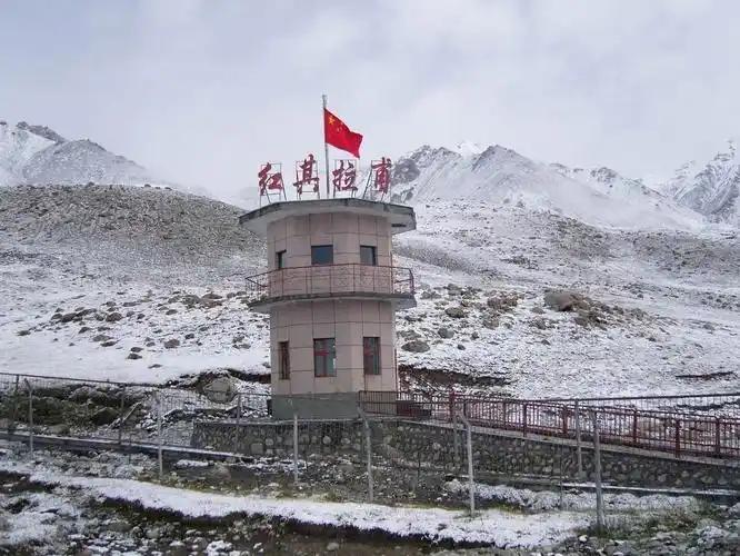
The high country near Khunjerab. Even in early autumn, expect freezing temperatures at the pass.
Stage three: the Panlong road to Yarkand
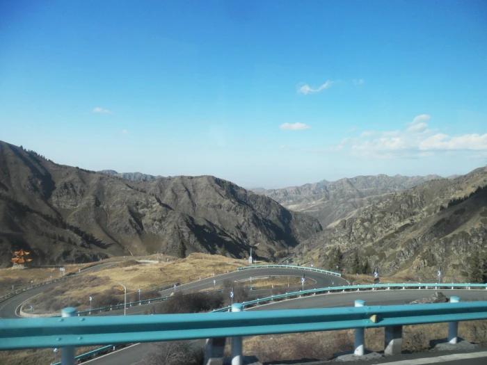
Here is where the circuit beats the out-and-back. Instead of retracing the KKH, turn east out of Tashkurgan county onto the Panlong Ancient Road — over 600 hairpin bends dropping off the plateau edge. The sign at the top reads, in loose translation, “today you have conquered all the curves life throws at you.” It is silly and everyone photographs it, including me, twice. The descent takes about two hours with photo stops and is genuinely hard on drivers; Memet chewed sunflower seeds the whole way down to stay sharp. The road is usually open May through October and closes after snowfall — check conditions the day before, because a closure means backtracking the entire KKH. Full details in our Panlong Ancient Road guide.
At the bottom you are back in oasis country. Yarkand (Shache) makes the logical overnight: the Amannisa Khan mausoleum, a lively old-town bazaar, and almost no foreign tourists. From Yarkand it is a flat, unremarkable three hours back to Kashgar on the G315.
When to go
My September trip had stable weather and golden grassland but cold nights. The May trip gave green valleys and lambing season — we stopped twice for herders moving flocks across the road — but afternoon cloud hid Muztagh Ata both days. Locals told me June and September are the most reliable windows. July and August work but bring tour-bus crowds at Karakul and occasional washouts in Ghez Canyon. Winter is technically possible on the KKH portion, which is plowed, but Panlong closes, killing the loop.
Where to stay
Kashgar has the full range; book there for nights one and (if doing five days) five. In Tashkurgan I have tried both a standard hotel (Crown Inn, functional, warm, around 380 CNY) and Gulbahar’s family homestay (240 CNY with dinner and breakfast, shared bathroom, better stories). Yarkand has simple business hotels in the 200-300 CNY range; do not expect English at the front desk, and confirm the hotel accepts foreigners when booking — a handful still do not.
What to eat along the way
Eat well in Kashgar, adequately on the plateau. Highlights from my notebooks: yak-meat laghman in Tashkurgan’s small Tajik-run canteen on the main street (28 CNY, hand-pulled, properly chewy); fresh yogurt at Karakul; apricots in Yarkand that cost almost nothing and taste like they were engineered by someone who hates supermarket fruit. Carry snacks and water for the driving stretches — between Ghez and Tashkurgan the food options are one grim noodle stop and whatever you brought.
Practical tips from two trips
- Carry your passport AND the border pass on your body, not in luggage. We were checked five times in three days.
- Fuel up in Kashgar and again in Tashkurgan. Stations exist but queues at the canyon-mouth station can be long, and passengers must exit the car and walk through a gate at every station.
- Cash is nearly dead here; Alipay worked even at the Karakul yogurt stall. Keep 200 CNY cash anyway for homestays.
- Download offline maps before leaving Kashgar. Signal vanishes for long stretches.
- Sunscreen is not optional at 4,000 meters. I skipped it one afternoon in May and looked sunburnt in every photo for a week.
- If you would rather have all logistics handled, hiring through an agency is standard practice here — our guide on traveling Xinjiang with a local guide explains costs and how to vet one.
A sample 4-day itinerary
Day 1: Kashgar → Ghez checkpoint → White Sand Mountain → Karakul Lake → Tashkurgan. Sunset at the golden grassland boardwalk.
Day 2: Morning at the Stone Fortress; optional run to Khunjerab Pass gate; second night in Tashkurgan.
Day 3: Panlong Ancient Road descent → Yarkand. Old town and mausoleum in the late afternoon.
Day 4: Yarkand bazaar in the morning → drive back to Kashgar by mid-afternoon.
FAQ
Can I drive the circuit myself in a rental car?
Only with a Chinese driver’s license. International permits are not recognized in China, so nearly all foreign visitors hire a car with driver.
Is the loop doable by public transport?
Buses run Kashgar-Tashkurgan, but the Panlong-Yarkand leg has no scheduled service. As a loop, no — hire a car.
How bad is the altitude?
You sleep at 3,100 m in Tashkurgan and peak above 4,000 m. Most people manage with a slow first day and plenty of water; anyone with heart or lung conditions should talk to a doctor first.
Do I need a special visa?
No — a regular Chinese tourist visa plus the border defense pass arranged locally is sufficient for the circuit. Crossing into Pakistan is a separate matter entirely.
Are drones allowed?
Effectively no. This is a border zone; keep the drone at home and save yourself a checkpoint conversation.
Disclaimer: Details reflect the author’s visits in September 2024 and May 2026 plus follow-up checks at publication. Permit rules, road closures, and prices in border areas change with little notice — confirm current conditions with a local agency before committing to dates. This article contains no paid placements.
About the author: Fiona McArdle is a Glasgow-based road-trip writer who has spent fifteen years chasing mountain roads across four continents, from the Carpathians to the Karakoram. She has visited Xinjiang three times and maintains that the hour of driving south of Subash Pass beats anything in the Alps.